AseanMachine Selected
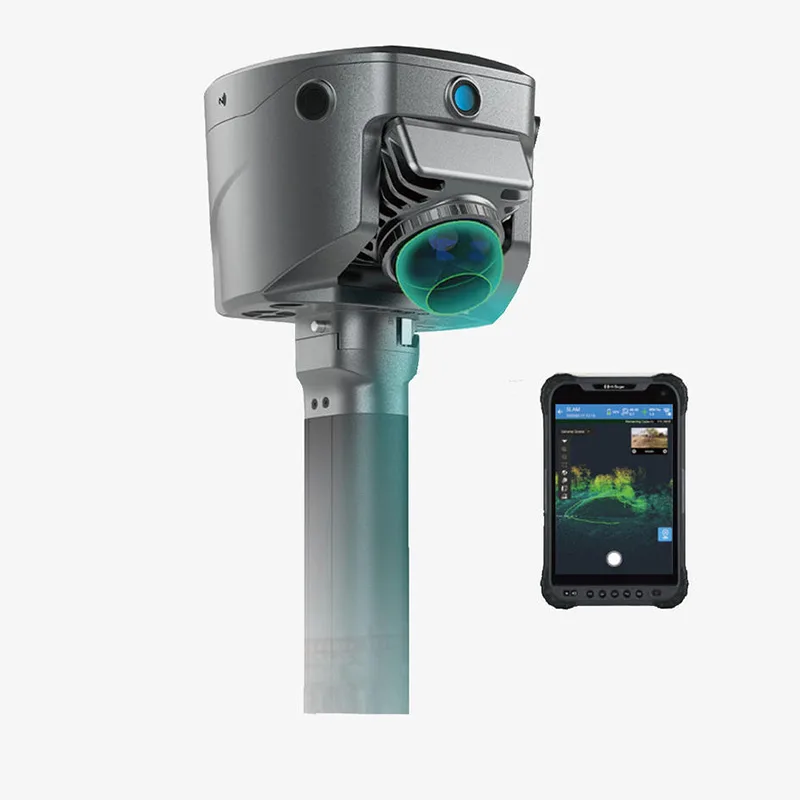
Handheld 3D Mapping Scanner
This handheld all-in-one 3D scanning device is designed for surveying, mapping, construction measurement, and complex terrain data collection. By integrating GNSS RTK, SLAM laser scanning, and visual imaging into a single portable unit, it enables fast and accurate acquisition of
Specifications
- Weight
- Approx. 1.68 kg
- Cameras
- 3 Professional Dual HD Cameras
- Storage
- 512 GB Internal Storage (Circulating)
- Dimensions
- Approx. 134.4 × 109.9 mm
- GNSS Support
- Multi-Constellation, Multi-Frequency
- Power Supply
- Lithium Battery
- Product Type
- Handheld All-in-One 3D Scanner
- Charging Time
- Approx. 2 Hours
- GNSS Channels
- Up to 1408 Channels
- Charging Method
- USB Fast Charging (45 W)
- Alignment Method
- RTK + SLAM Unified Coordinate Output
- Operating System
- Linux
- Working Distance
- Approx. 2 – 15 m
- Protection Rating
- IP64
- Battery Working Time
- RTK Mode: up to 10 h / SLAM Mode: up to 5 h
- Laser Scanning Range
- 0.1 – 40 m (10%), up to 70 m (80%)
- Measurement Accuracy
- Better than 5 cm within working range
- Network Connectivity
- Bluetooth / WiFi / Cellular
- Operating Temperature
- −20 ℃ to +55 ℃
- Measurement Technology
- RTK + SLAM + Laser Scanning